Charlottetown PEI - The End! Charlottetown PEI - The End!
It all ended way too quickly... One minute we're living the dream, the next minute it's over. Now, here we are a couple of months later and it all seems like maybe it was a dream - did we really ride across Canada???
No, it wasn't just a dream. From June 2nd to July 31st:
· We were on the bikes riding for 280.8 hours, 12 full 24-hour days, or 16,845.8 minutes.
· We turned the pedals 1,313,972 times.
· We rode 6,125.8 kms or 3,806.6 miles.
· We crossed 8 Provinces, 4 States, 5 time zones and one continent.
· We stayed in 45 different hotel rooms and were pampered in the homes of 3 awesome hosts!
· We helped to raise over $10,000 for the El Jordan Center!
and.....
· We rode from sea to sea living the dream that had sprouted 15 years ago!
It seems odd that after dutifully and diligently maintaining our blog each of the 62 days from June 1st to August 1st that it has taken us so long to prepare our final blog entry! We aren't exactly sure why it has been so difficult to get this done, but we assume that it has something to do with having exerted so much energy over the 60 days of the trip - both physically and mentally - that we needed to sit back, rest, let our bodies and minds recover and reflect on what we did and what it meant to each of us. The stories and experiences were easy to tell while we rode each day, but it is much more difficult to take the whole adventure and encapsulate it into one final entry. In any case, we've finally got it done. Although it feels inadequate to us after such a huge adventure, here it is... sorry for the length!
 I can't believe she hugged me! I can't believe she hugged me! Cam's Final Entry
Life has definitely been interesting since completing our adventure...
I turned 50 on August 2nd, the day after I flew from Charlottetown PEI to Chicago to meet Sue and the girls! So far, 50 doesn't seem so bad! I wish that I had a video of my journey from Chicago's O'Hare Airport to the hotel in downtown Chicago. I dragged my crated bike along behind me while carrying 60 pounds of panniers over my shoulders through the airport, onto the train, through the massive downtown Chicago subway station, up the escalator, and about a kilometre around downtown Chicago, getting lost en-route to the hotel which probably cost me about 3/4s of that kilometre...! When Sue opened the hotel room door, my newly acquired Prince Edward Island t-shirt was drenched as a result of the 30+ degree temperature. She must have really missed me because she gave me a huge hug anyways! I'm sure the girls missed me too, although their hugs kept a little more distance between them and me!
After helping our daughter Ellyssa move into her downtown Chicago apartment (she is attending Robert Morris University and playing for their volleyball team), we spent a couple of weeks in Scottsdale before driving back home to Calgary in late August. While in Scottsdale, I quickly learned that while stronger riding legs help you to get up the mountain more quickly, they don't necessarily help you stay on the mountain bike when riding down the mountain... I have a few scars to help me remember that lesson!
 My first dinner as a house-husband! My first dinner as a house-husband! Since then I've been getting caught up after being away for 3 months. I have also been learning how to cook, clean (including the toilets!), do groceries, etc... as Sue has returned to teaching full time and I am taking care of her, Brendan and Alexa until I start my next thing (whatever that might be)...! I think that this has been almost as much of an adventure for each of them as riding across Canada was for Ken and I!
Seriously. though, it has been great to get back with my family after such a long absence - the longest that Sue and I have ever been apart from each other for over 25 years! I am so grateful to her for supporting this hare-brained dream even though it put a great deal of stress on her back home )even more stress than I was aware of as she didn't want to bother me with things while I traveled). Thank you Sue for this 50th birthday gift that you gave me - I love you!
 So, what did the trip mean to me in the end? What did I learn? That can probably best be answered by responding to some of the questions that I get asked when talking to people about the trip...
Still Friends? I'll start by saying that one of the main things I learned was what a great friend and mentor Ken is to me. At the beginning of the trip I wrote that I couldn't imagine doing this with anyone else but Ken, and it is amazing that I feel even stronger about that after spending over 60 days together - 24/7. Thank you for sharing this adventure with me Ken!
 How'd It Go? When people ask me about how the trip went, my first response is that the trip exceeded every expectation that I had envisioned for it as I dreamed about it over many years. It truly surprises me to be able to say that, as often the reality of things we "want" end up being less than we imagined that they would be. I think that it helped that throughout the entire trip, Ken and I were both able to remember and appreciate that we had been given a very rare opportunity to complete a trip like this. Every day as we did the "Living the Dream" high-five, we were reminding ourselves of how lucky we were. This helped us to appreciate even the little things along the way like the smell of the pine trees in the Rockies, the crops dancing in the wind on the prairies, and the smiles and well wishes of so many kind people we met along the way. I truly don't think the trip could have turned out any better!
Find yourself? I really wish that I could say that I "found myself" or learned a lot more about myself on the trip... I really made an effort to reflect and pray about what was next for me, with many suggesting that a trip like this would help me to put it all together. However, I have to say that I had no epiphanies along the way that suddenly made all of this clear. That doesn't worry me though, as I know that God has a great plan for me and my family and that He will make it clear in His time.
The Highlight? I have found that it has been very difficult to answer the question "What was the highlight of the trip?". Surprisingly, even to me, the response that I have given to this question is that my highlight was the night we spent in the Piapot Saloon and Guesthouse. Some of you may recall that on Day 13, we found ourselves staying in the tiny town of Piapot Saskatchewan having happened across a post card for the saloon at the tourism centre near Maple Creek, SK. The rooms were the only ones that would avoid us having to take an 8 kilometre detour south of the highway to a hotel in Maple Creek, so we booked one of the guest rooms. Although green shag rugs, 1970's particle board wood paneling, and a small double bed weren't the most luxurious, watching a Roughrider's football game while observing the small town life go on around us in the saloon turned out to be a highlight. We met oldtimers and newcomers, and were a part of their small town life on the prairies for one night. It felt like we were in an episode of "Corner Gas"! Reflecting on this "highlight", I realized that our most memorable moments from the trip were those times that we were engaging with, or even just observing, the lives of the people we encountered along the way. If I were to do it again, I think that I would stay in a few more bed and breakfasts or places like the Piapot Saloon along the way. These were the places where we had the greatest opportunities to meet and engage with people.
 PEI was beautiful and we'd like to go back... PEI was beautiful and we'd like to go back... Nicest Region? People also ask what region(s) I enjoyed the most. The two segments that stand out to me were Prince Edward Island (although we only saw it for half a day) and the segment from Montreal to Rivière-du-Loup in Quebec along the Saint Lawrence. Both were beautiful and full of interesting places that we would have liked to see more closely and with more time. Although those were the standouts, some other segments also stand out in my memory.... Although I often get jokes about how dull it must have been riding the prairies, I really enjoyed traveling through them. Although the landscapes have less majesty than some of the other areas, there really is a lot of beauty especially when you are able to get close to it. I remember sitting off the highway appreciating the rolling hills, the blowing crops and the barbed-wire fence stretching far into the distance. There were many similar prairie experiences. We also really enjoyed our detour through the United States. While much of the route was through regions that were not economically prosperous, we really enjoyed the people we met through there, some of whom demonstrated "Minnesota Nice" and some who good-naturedly called themselves "Yoopers"! It was truly a unique experience for us.
How're The Hands? I had some issues with nerve damage in my hands from leaning on the handlebars for so many hours a day. I described these issues in more detail on Day 10. I'm happy to say that after 60 days, my hands are at about 95% and I expect that they will be back to 100% again by the end of October. The nerve damage - known as Cyclist's Palsy - is temporary and the nerves regenerate with time....
 Ken's Final Entry
It's two months to the day since I returned home to Calgary. My flight home was a kind of adventure in itself. It somehow went from a non-stop flight to a "Toronto stop over but stay on the plane flight" to a "stop in Toronto AND change planes" flight. Thankfully most of the crying babies got off in Toronto! After what seemed like an eternity I finally made my way down the long corridors and into the welcoming arms of my wife Elaine. She was joined by our children and several other family members who kindly stayed up late to form the welcoming committee.
...the final arriving!
After much hugging and rejoicing (when the box with my bike showed up!) we piled into the vehicle to head home. It was strange to be driving again after a two month break! When I walked into the house I received another enthusiastic welcome from our dog Sully. He really seemed to know that I had been gone for awhile!
Four days later I was back on the bike for the 12 km ride to work downtown. I remember feeling like the ride seemed short, compared to what I had become used to! I was fortunate to have my job waiting for me when I returned to Calgary, and was surprised by how easily I adjusted to the daily work routine. I remember talking to Cam at one point early in the trip about what that was going to be like. I guess the realities of financial responsibilities have a way of helping you re-adjust!
Cam has already articulated the significant learnings from the trip in a most eloquent manner. I would like to add my personal observations - in no particular order they are:
1. To hear a meadowlark, you must leave the city!
2. Pringles are an excellent snack for any kind of trip, including cycling because they are light and are hard to crush. (I learned this from someone who climbed Mt Everest!)
3. Alberta's lakes and rivers are the cleanest anywhere!
4. A good cowboy always looks after his horse! (So take good care of you bike, including pro-active maintenance!)
5. There are lots of houses, cars, trucks and boats for sale all across this country!
6. McDonalds and Tim Hortons customers are the biggest source of litter from coast to coast.
7. Never go against a Sicilian when death is on the line. (OK, this might belong to another list!)
8. The human body has an amazing ability to adapt and strengthen itself.
9. I am truly blessed to have a friend like Cam but....
10. I'd like to do my next adventure with my wife and best friend Elaine!
 Roly Roy - "One of a Kind"! Roly Roy - "One of a Kind"! Joint Observations
There were many observations and experiences that we shared on this trip. Some of these that we agreed on were:
We both found that the actual riding was probably harder than we thought it would be. While we definitely got stronger along the way, it was almost always a challenge to ride for many hours a day. This wasn't a negative to us, as we often commented that "If it was easy, everyone would be doing it", but it was a surprise as we had expected that the riding would get much easier as we went. The hardest days were Day 4, the second day of the Coquihalla, when we expected it to be flat but had 55 kilometres of hard climbing, and Day 23 when we rode 9.25 hours and 168 kms to Grand Forks North Dakota, against the wind in 30+ degree heat with a deadline to meet my cousin Kirsten and her family for dinner! Over the last quarter of that day, Cam had to get up out of my saddle at least once a kilometre to relieve his aching derriere!?!
Another thing that really stood out to us we crossed the country was what a difference excellent customer service makes as we visited a multitude of restaurants, hotels and other retail operations. It truly is amazing how much different the exact same activity can be when you are dealing with someone who really cares about your experience versus someone who doesn't. We really appreciated those who cared about our experience, including Alison (AJ), Dick and Allan - just to name a few!
Along a similar theme, it is amazing how in an encounter that last just minutes, some people can impact the rest of your lives. We had many such experiences with our "Heroes" and "Angels" that we blogged about all along the way and we were so thankful for all of those people! Of all these encounters, we will never forget, and have been truly changed, by our short time with Roly Roy from the small town of Hagar Ontario. He called us over to his house as we rode by on Day 41, then after joking around with us, proceeded to make several trips into his house coming back with things he thought we could use, including fruit, water, cookies, peanuts, Coke, and even a donation for El Jordan. It was so amazing to us to meet someone who was so full of kindness and joy, and who could tangibly pass that joy to us in a short 15 minute encounter...! Thank you Roly - we hope that we can follow your example and learn how to share joy and kindness like you did to us!
 The seemingly abandoned house... The seemingly abandoned house... Compared to the number of Heroes/Angels we met, there were only a small number of negative encounters along the way. We wrote in our blog about a semi-trailer driver who moved his truck towards us on a narrow rainy secondary highway in Manitoba on Day 22 to scare us (which he did passing just a foot or so from our sides and almost knocking us from the road with wind, spray and shock...). After passing, we saw him move his truck back left to the centre of his lane... We didn't write about a very bitter and angry farmer who threatened to sik his large dog on us after he found us taking pictures in what we thought was an abandoned, haunted-looking cabin just off the highway. After about 10 minutes trying to convince him we meant no harm, he finally let us pass by and get on our bikes to ride on. Interestingly, this was just a few hours after we had met Roly Roy and showed us how some people expect to find the worst in people, whereas Roly had expected to find the best. We learned during our standoff that someone had torched the farmer's cabin one night, destroying everything in it. Knowing this, we understood where his bitterness came from, but it was interesting to us to contrast this with our earlier experience with Roly. We felt sorry for how this man's experiences had impacted him so negatively.
Apart from general litter, we were surprised by the three most common things we saw lying on the side of the highways across the continent. Number 1 was various types of straps/bungee cords. Number 2 was bumper ends from RV's. The one that really surprised us (and scared us) was number 3 - beer cans. It is hard to believe how many beer cans we saw along the way. Our only hope is that it was passengers tossing these out the passenger side of the car, but sadly, we are sure that often it is the driver. Scary...
And so, that is it! We are so thankful to those who loyally followed along on our adventure and offered us encouraging comments. Those comments and emails were like rocket fuel on the road, encouraging us to soldier on. It still amazes us that anyone found our story very interesting, but we have heard many who suffered from "blog withdrawal" after we finished the trip. The website is still receiving 40 - 60 page views a day! It will be a great resource for Ken and I to relive our adventures for many years (which was the original purpose for deciding to do a blog). Beyond this, we hope that what we learned and documented can be a help to others who want to cycle across the continent - or for anyone who wants to live their own dream, whatever that might be...! We will never forget the wonderful comment from little Noah on Day 11 who told us "Thanks for letting us share your dream. Makes me want to dream big"!
As for the two of us, we are now high-fiving our wives every morning and giving a hearty "Living The Dream"!
Happy Trails!
Cam and Ken
 Our hike to the hotel after dropping our bikes at the bike shop... |  ...we couldn't believe how heavy the gear was that we carried on our bikes for 6,125 kms! | Our adventure ended pretty quickly with the dipping of our wheels in the waters of the Atlantic at Charlottetown. We enjoyed a great meal in historic downtown Charlottetown and then headed to the hotel for our final night before returning to our families. It was quite late when we got back to the hotel and began our final blog entry, as well as working to complete our "Cross-Canada in 4 Minutes" videos. This took most of the night and Ken and Cam got very little sleep on our last night... It was about 6:35AM when Cam finally got notice that the videos were loaded to Weebly. For those of you who found the Weebly videos didn't work, we have now loaded them to Youtube and they are linked on our home page. Click HERE to go to the home page, scroll down, and watch the videos.Ken and I are working on a final epilogue entry that will give our final thoughts/learnings from this great adventure. We will post this in the next few days, but before that, we wanted to pass on a message that El Jordan sent to it's followers celebrating the completion of our journey which is copied below. They want to say thank you to all of those who donated to support their efforts to help kids get off the streets of Santa Cruz Bolivia. Ken and I truly appreciate those of you who have given to support El Jordan. We don't have a final number yet, but we believe that total donations were about $13,000-$15,000!!!! If you haven't had a chance to visit the Donate page to support this awesome work - it's not too late.... just click HERE! Email to El Jordan Followers from Corina Clements - August 9, 2013:
Do you remember Cam and Ken who were driving their bicycles across Canada??? Two months, Horseshoe Bay BC to Charlottetown PEI and 6,125.8 kilometers later… they completed their dream!!!
Congratulations Cam and Ken!!!! …and THANK YOU for including El Jordan in your adventure… and THANK YOU to everyone who donated to our ministry in their honor!!! You can’t really see the sign very well… but it says “Gracias Cam y Ken”. We appreciate what you did for us!!!
Who would have ever thought that God could provide for our needs through two people driving their bikes across the country? God never ceases to amaze me
 A gathering to says thanks to those who supported El Jordan as Cam & Ken journeyed across Canada... |  The banner from the students at El Jordan read "Thank you Cam and Ken!". |
 Day 60 - Cap-Pele' NB to Charlottetown PEI - 120.6 kms  Day 60 Progress - Horseshoe Bay BC to Charlottetown PEI - 6,125.8 kms  An "early" start An "early" start Our alarm jarred us awake "early" (7:00AM) on this last morning of our adventure with a goal to get away by 9:00AM. We came pretty close - we wheeled away by 9:30AM for our final day of riding with the sun shining, the sky blue and the breeze at our backs. Somehow we knew that our final day would be in good weather even though we had been riding in clouds for a number of days...!
On our way past the beach turn off we noticed that it's actually called L'Aboiteau Beach, not Sandy Beach as reported in yesterday's blog. So in the interest of accuracy we have corrected yesterday's entry. Just as an aside, the word "L'Aboiteau" refers to the drainage channels the Acadian settlers used to reclaim the land from the sea.
Our plan today was to follow the Acadian Coastal Trail, hoping to see a lot of the coast on the way. The initial portion was inland, including an unfortunate ride past a crab waste processing facility! (We suspended the "deep breathing" for awhile!) The shoreline eventually did appear on our left, providing numerous photo opportunities - none bigger than the appearance of the Confederation Bridge in the distance. It was interesting that this road - Highway 955 - did not even appear as an option in the bicycle routes suggested by Google Gretta, even though it was much more beautiful riding than the routes suggested by her - and with very little traffic. Gretta certainly has a lot to learn...
We passed the miles on this part of the trip by working through the memories that jumped to mind for each day of our trip starting at Horseshoe Bay and moving day by day. It was fun to remind each other of so many awesome experiences along the way!
 An inlet along the Northumberland Strait which runs between New Brunswick and Prince Edward Island  Our first sighting of the Confederation Bridge (on the horizon)  We enjoyed our remaining kilometres in New Brunswick on mostly flat roads and arrived at the Confederation Bridge visitor information centre just before noon. Since pedestrians and bicycles are not permitted to cross the bridge, a shuttle service is provided 24 hours a day free of charge. (We learned as we approached the bridge that there is no charge to travel the bridge into Prince Edward Island (PEI), but there is a toll to come back across to New Brunswick.)
The shuttle arrived just as we pulled up, and in no time our bikes were loaded onto the bike trailer and we were off to PEI. The Confederation Bridge is almost 13 kms long and was completed in 1997, replacing the ferry service. We lead a truck pulling a wide mobile home across the bridge, so traffic coming from the Island was halted until our convoy completed our crossing. A long string of traffic was waiting to head West as we rolled into PEI and we estimated that they would have had to close the West-heading traffic for about 25 minutes, first to clear the bridge and then for us to cross. We were thankful we didn't get stuck in a similar line-up as we had to get to Charlottetown, dip our wheels into the ocean, and then get our bikes to Macqueen's Bike Shop by 5:30PM where they will be crated for tomorrow's flights.
After a quick seafood lunch at the "touristy" Gateway arrival area, we started out for Charlottetown, once again endeavoring to avoid the TransCanada highway as the waitresses warned us that it had many steep hills! In order to accomplish this we would rely once again on Google Gretta... (We are suckers for a good adventure it seems! Besides, the Island is not that big so what could possibly go wrong?!?)
Once again, the back roads did not disappoint us with respect to getting closer to everyday PEI and providing us with amazing scenery. We were constantly reaching for our cameras as one beautiful landscape followed another. The intensity of colour and texture seemed to explode at us today, perhaps drawn out by the bright sun. We both agreed that the beauty of this section of our ride rivaled anything else that we had seen on the entire trip.
The downside of following Gretta once again was that she took us on a number of sections of gravel type surfaces and we certainly didn't avoid hills as the roads were generally built straight up and down the hillsides, rather than going around them. These were usually steeper than what we have seen through much of our trip with one reaching a grade of 13 percent!
 Hills - PEI style! |  If we weren't going up a hill, we were heading down one... | During one of our frequent "route check" stops deep into Google Gretta's back-road adventure, we heard a dog barking and then a friendly voice asking us if we needed directions. We had stopped directly in front of Debbie Matters' rural driveway, and soon she was filling our water bottles with refreshing cold water and giving us directions for alternative routes to Charlottetown. Debbie is a fellow cyclist and triathlete! As we have seen a few other times on our trip, her generosity came at just the right time as the afternoon heat and multiple hills were depleting our water stocks. For her kind hospitality and friendliness we are naming her our "Angel of the Day"! Thank you Debbie!
 Our final "Angel of the Day" Debbie (with Jude) 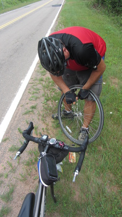 Flat Tires: Cam 8, Ken 1... Flat Tires: Cam 8, Ken 1... Our ride was still on schedule to get to Confederation Landing in Charlottetown by 4PM, giving us plenty of time to enjoy the final "arrival" and then to get our bikes to the bike shop before they closed at 5:30PM. As Debbie had promised, our route still had plenty of hills to climb, including the 13% hill we mentioned earlier. As we approached an important turn onto Kingston Road that would take us to Charlottetown, Cam started to notice that his ride was dragging a little bit, and not long after that, he realized he had a flat on his front tire...! It was amazing that he had covered 6,105 kms without a front tire flat, and this hit about 20 kms from our final destination. With our tight deadline, we quickly got to work. We found and removed the sharp sliver of metal that had caused the flat, and were on our way with a new tube. However, as has been the trend on this trip, within minutes the front tire was flat again. Once again, we moved very quickly to fix the tire, worried about our timeline to get to the bike shop. It seems that the tube must have been faulty as there were no more slivers in the tire, and the second replacement tube held air just fine.These repairs cost us about 20 minutes and so we were forced to ride harder to finish the final 20 kms. With 17 kms to go, the words "just one ride home from work" went through Cam's mind for the last time and he smiled recalling how he had used this little trick about 50 times over the last two months to help put the end of each day's ride into perspective.
As we approached Charlottetown, thankfully the land flattened and we started to make better time. We had seen online that the Confederation Landing park in downtown Charlottetown looked like a good place to finish the ride, but we didn't know what was there or whether we would be able to access the water to ceremoniously dip our wheels into the waters of the Atlantic as we had done in the Pacific Ocean at Horseshoe Bay 60 days ago.
Google Gretta lead us skillfully through the busy city. We had been able to work through the emotional side of the completion of our dream over the last few days, and both Ken and Cam felt a growing excitement as we rode the final roads of our adventure. Gretta took us by historic buildings, bustling retail areas and quaint restaurants, and then we turned a corner and suddenly we were at the water with a boat launch inviting us to ride directly down and into the ocean. Ken rode first and gave a fist pump as he fulfilled his dream. Cam followed and a thumbs-up signaled the fulfillment of his dream. This was followed by one final high five and exclamation of "Living the Dream!" And with that, it was over. We both agreed later in the evening that our adventure had surpassed our highest expectations in every respect. It has truly been our trip of a lifetime!
 We made it! With that done, we raced a couple of kilometres to the bike shop and arrived just before they closed. We left our bikes and carried our gear about a kilometre to a Quality Inn where we got the last room - which turned out to be a beautiful suite in a heritage building on the property at regular room prices. It was a great place to spend our last day together!
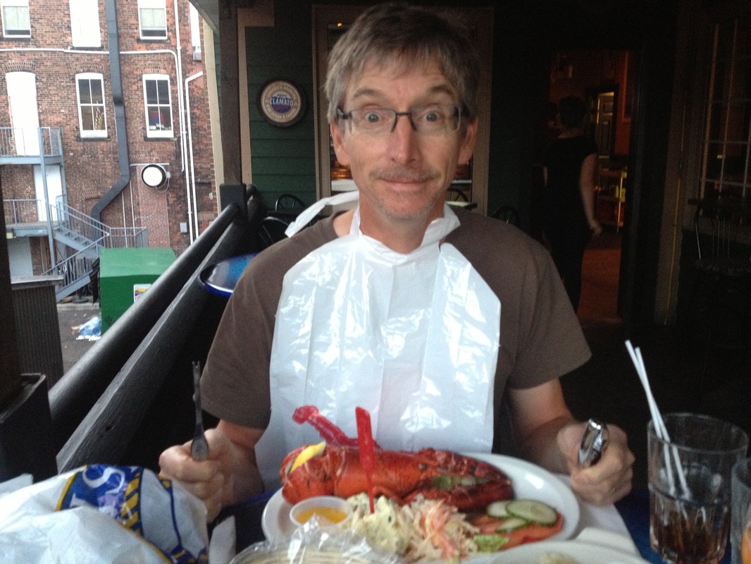
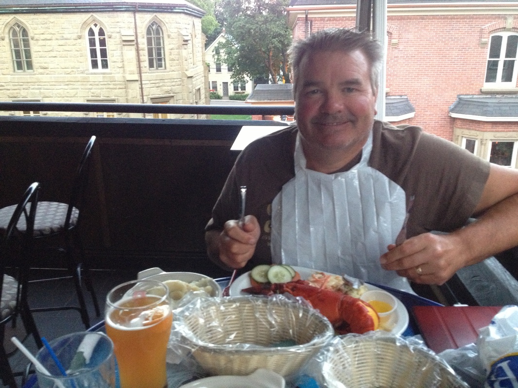
After cleaning up, we set out to find a suitable restaurant for our celebratory dinner. There were many to choose from but we agreed on The Olde Dublin Pub with its third floor patio. We both ordered The Lobster Dinner which was delicious! While we ate, we relived some of the many highlights we experienced on this most excellent adventure. We also agreed that we have the most awesome wives ever to support us so on a huge trip like this. It hasn't been easy for them to handle everything on their own and we can't wait to get back to see them and to share our excitement at having completed this dream. Thank you so much Elaine and Sue - you are our Heros of the Trip!
We've summarized our rides from coast to coast in the following short videos - we hope that you enjoy!
| Cam's Cross Canada Adventure
Youtube Version
Weebly Version (HD)
| Ken's Cross Canada Adventure
Youtube Version
Weebly Version (HD)
| Ride Details: - Distance: 120.6 kms - Riding time: 5 hours, 32 minutes - Average speed: 20.8 kms/hour - Wind: West, light - Temperature: 24 degrees Celcius - Cumulative: 6,125.8 kms Tomorrow's Destinations: Ken - Calgary to see his family! Cam - Chicago to see his family! For more ride details, see Strava. For more photos from today, see our Photo Gallery.
 Day 59 - Moncton to Cap-Pele NB - 60.5 kms  Day 59 - Progress to Cap-Pele NB - 6,005.2 kms  Getting ready for today's ride Getting ready for today's ride With our late night arrival into Moncton, and needing to catch up on the photo gallery from Day 57, the night slipped away far too quickly. After the long day, we were both exhausted and once the photos had been uploaded on a very slow hotel internet, we decided we would complete the blog in the morning and get to bed.
The alarm came too early and we ended up blogging before, during and after the free breakfast in the lobby of the Travelodge. The picture uploads were much faster in the lobby because we were closer to the wifi signal.
 Navigating the streets of Moncton Navigating the streets of Moncton We had made the decision last night to change our Day 59 destination from Port Elgin to Cap-Pele' so that we could travel along the coast of the Atlantic Ocean (via the Gulf of St. Lawrence) as we rode towards the Confederation Bridge which would take us to PEI on Day 60. This meant that today would be just 60 kms (one third of the distance we rode yesterday) and so we were looking at today as a bit of a "mini rest day". We took full advantage of the 12:00 check-out time and didn't ride away from the hotel until about 12:15PM. We took a scenic route through Moncton which really didn't make a big impression on us. We were only there a short time, but our experience was that the drivers in Moncton seemed particularly impatient with cyclists compared to what we have noticed in most other cities.
 Our route to Cap-Pele' took us 35 kms to the town of Shediac located on the coast. We rode through beautiful countryside with forests, farms, old and new houses, cattle, barns, silos.... Cam felt no compulsion to hurry the ride, rather wishing to slow it down. He found himself drawn to look closely at the houses he was riding by trying to take in all of their details while wondering who lived there and what life there was like. He breathed deeply as they rode through the forests wanting to be able to remember the smell of New Brunswick after we are gone, and he noticed that the air began to taste of salt as they moved closer to the ocean. A cycling adventure like this lets you get about as close to our country as you can while you cross it, however, he has found that even seeing it in this way leaves him wishing he could experience it more closely - meeting more people and being able to stop and experience more of the world that was passing by...
He also realized as he was riding along why this blog that he and Ken have so painstakingly maintained is so important. It is great to be able to share our adventure with our family and friends in this way, but it is through these entries that we will be able to remember and to cherish our adventure. They will help us to remember the smell of New Brunswick, the character of Quebec, the characters of Michigan, the challenges of BC, the many friends who supported and cheered us along the way, and so much more.
 That's a big lobster! That's a big lobster! At about 2PM, the Gulf of St. Lawrence came into view shortly before we arrived at Shediac causing a rush of excitement and a growing sense of accomplishment. We had ridden from sea to sea!
As we rode into Shediac, we got a further rush of excitement to see the world's largest lobster proudly displayed there...! After the obligatory photos, we had a craving for lobster - or at least seafood - for lunch. Fortunately there are several local establishments featuring seafood on the menu, so we had no trouble satisfying our appetites. In fact, Cam had a double serving, later stopping at McDonald's as we had seen an advertisement for a "McLobster" sandwich and he just had to give it a try. It was quite a treat, but it could have used a little less of the sauce - which is pretty similar to the sauce on the McChicken sandwich...
 The Gulf of St. Lawrence The Gulf of St. Lawrence After lunch, the road to Cap-Pele' followed the shoreline of the Gulf of St. Lawrence, making for plenty of photo stops. It was also in this stretch that we reached another distance milestone at 6,000 kms!!! We once again stopped to mark the milestone, did a high five, and got back to the business of completing the ride. We arrived in Cap-Pele' at about 5PM and stopped at a visitor information booth to explore our accommodation options and to get some supper recommendations. Unfortunately, our accommodation options were limited to Seely's Sandy Beach Motel. Fortunately there were plenty of rooms available.
 L'Aboiteau Beach L'Aboiteau Beach On our way to supper we rode down to nearby L'Aboiteau Beach! This beach features a beautiful sandy shoreline. According to the posted tide schedule we were there precisely at high tide for today - 7:14 P.M.
We then headed to Fred's Seafood Restaurant for some local seafood, followed by a quick trip to a convenience store for some snacks. This will provide the fuel we need for our late night blogging.
And so, we head to bed on the eve of the last day of our adventure. Tomorrow will be a longer ride at 122 kms and we will need to arrive at Charlottetown by 4PM so that we can get our bikes to a bike shop to be crated for our flights. Therefore, we want to get away from here by 9AM at the latest. This will mean a very early alarm compared to what we have grown used to over the last few weeks.
From the East coast....Good night...!
Ride Details: - Distance: 60.4 kms - Riding time: 2 hours, 57 minutes - Average speed: 20.5 kms - Wind: Negligible - Temperature: 22 degrees Celcius - Cumulative: 6,005.2 kms Tomorrow's Destination: Charlottetown, Prince Edward Island - 122 kms For more ride details see Strava and for more photos from today's ride see our Photo Gallery.
 Day 58 - Fredericton to Moncton NB - 173.4 kms (the second longest day of our adventure!)  Day 58 - Progress to Moncton NB - 5,944.7 kms  No free breakfast at the Crown Plaza... No free breakfast at the Crown Plaza... You might recall that in the early days of our trip, our hotel criteria were very clear (price, free breakfast, hot tub), however, over the course of our adventure, these criteria have changed. We found that about 25 - 30% of the way into the trip, the presence of a hot tub became less important to us as our conditioning improved and our muscles were less fatigued at the end of the day. We also found that we wanted to have a little more time to get out of the hotel at night to see a little of the towns we were in while we sought a place for dinner. More recently, we have found that a free breakfast dropped out of the criteria as it has become more important to find a hotel at all... It seemed that over the first 75% of the trip we never worried about finding a hotel - rather, the trick was choosing among a few. Since leaving Montreal, as we've traveled through smaller towns off the main roads, and just finding a hotel has been a challenge - sometimes because of their scarcity, and sometimes because it is summer and they are full.
 The hotel-less wilderness of New Brunswick... The hotel-less wilderness of New Brunswick... The scarcity of hotels impacted our ride on Day 58 in a big way. We built our original schedule back in January using the online AMA Triptik tool - which was extremely helpful. We knew that we had to ride 110 kms a day on average through the trip, and so for each day we would look for a town around the 110 km mark, and research it to ensure there was one or more hotels. For Day 58, we selected Petitcodiac, NB, which meant a 140 km ride. However, as we went to book a reservation the other night, we couldn't find any accommodations of any sort in Petitcodiac - or within 20 kms of the town. We researched alternate routes and asked anyone that we could, however, it seemed that the last half of the trip from Fredericton to Moncton (170 kms) was a pretty remote wilderness with the only accommodations West of Moncton being a B&B in Salisbury at about 155 kms.
So we set off this morning with an unusual day planned - we would ride 120 kms and then take the first accommodations that we came upon. Our original route plan was to take Highways 102/105 and 112 - thinking that there was more chance of running upon a remote motel on these back-roads than on the TransCanada.
 "Do you think that's a bad sign?" "Do you think that's a bad sign?" We knew that there was a chance that we would end up staying in Moncton, which would mean the second longest day of our trip, however, we didn't get on the road until 11:30....! First, Cam had to ride to a nearby bike shop - the Radical Edge - to replace his rear tire. As we have found consistently on the trip, the service staff put Cam's bike at the front of the line. Unfortunately, the shop didn't carry the Schwalbe Marathon tire he had used since Brandon and that hadn't had one flat since then. However, they recommended another tire and Cam was riding away from the shop by 9:20AM. Interestingly, the technician told him that he could probably have made it to Charlottetown on the "blue rubber" as touring tires give a long warning to avoid stranding touring cyclists in the middle of nowhere... Cam feels better having a new tire however as he had enough flats in the first part of the trip and doesn't need another!
Ken had been trying unsuccesfully to upload pictures to our website in the hotel room and sent an email to the support team at Weebly. After getting packed up, we stopped at Cora's for breakfast and then at Tim Horton's to see if we could upload pictures there - which worked just fine. It appears that the hotel wifi was the problem... In any case, this took us to 11:30AM before we were on our way!
We followed Google Gretta (?!) onto a beautiful, freshly paved paved trail for about 5 kms. Eventually, a "trail closed" sign gave us concern. However, using Google Maps we saw that the bike trail closely followed the roads and so we chose to take the roads to get us to Highway 102. This road took us to the Barton Bridge which took us North across the St John River. There, we took Highway 105 about 35 kms to the little town of Jemseg where the road intersected with the TransCanada Highway and where we found the "Turner's One Stop" cafe which served us a surprisingly good lunch. It was there that we had to make a decision on taking Highway 112 or to get back onto the TransCanada. We asked the waitress, and she didn't know if there were any motels on the 112. Having seen very little development on the 105, and based on the lack of any online signs of life on the 112, we decided to take the TransCanada for the first part of the afternoon, but to take a crossroad over to the 112 if we didn't like it.
 A bridge over a tributary to the St John River - the day was cloudy and misty all day  Back to the TransCanada...look at the beautiful shoulder! Back to the TransCanada...look at the beautiful shoulder! The TransCanada has been recently re-paved on this segment and had shoulders that must have been 10 feet wide. Although we were once again riding with semi's and monstrous RV's, we felt very comfortable with our broad lane, which was lined with rumble strips along the left edge. The countryside has become less hilly than the stretch from the Quebec border to Fredericton, and so there weren't as many hills as early stretches that we had ridden. When it came time to make the decision whether to move to the 112, we decided to continue on the TransCanada as we weren't comfortable that there would be any better chance of finding a motel on that road.
 Another hill looms in the distance... Another hill looms in the distance... Today's ride with no specific destination/distance provided a bit of a mental challenge to Cam as he has developed a fairly consistent approach to monitoring his daily rides. He marks each of the following points with mental milestones - 10%, 20%, 25%, 1/3, 50%, 2/3 and 75%. By doing this, it helps to feel that we are making progress each day (and there is a lot of time to think about such things on the road!). Another game that he plays starts as we begin to get closer to the destination. Cam's ride from home to work was 17 kms. When we are 34 kms from the destination, he says "Just a ride to work and back", which makes the remaining ride seem pretty manageable (in spite of it still being about an hour and a half!). At 17 kms, it was just a ride home from work. Some days, this game starts at 68 kms, meaning 2 days of rides to work, but that isn't quite as comforting...!
This day turned out to be a good test of our conditioning. The kilometres passed quickly after lunch and we were surprised to be suddenly 10 kms - and then 20 kms - away from Jemseg. Although less hilly, there were still many hills of 1 to 2 kilometers in length and running grades of 4 - 5%. Several of these came after we had already ridden 100+ kilometres. We both noticed today that we could climb these hills and get to the top without feeling that tired. Thinking back to the beginning of the trip, these types of hills would have left us huffing and puffing pretty heavily at the top. We guess that riding 6,000 kms across the country is good for your fitness!
 At 9PM, 173 kms later, we rolled into Moncton! At 9PM, 173 kms later, we rolled into Moncton! We continued riding and reached the town of Salisbury at 155 kms at about 8:00PM without having seen any overnight accommodations in over 100 kms! We called the Salisbury B&B, but the number had been disconnected. There were no other visible options (or online options) and so we decided to go another 18 kms to Moncton (that's just over a ride home from work!). Although the day had been very cloudy and misty, we were amazed that we had not been rained on all day and we rolled into Moncton just as darkness was descending. We had about eight hotel options within a 0.5 kilometre radius, however, no restaurant options (?!?) and so we ordered pizza to the room for the first time of the trip. We weren't in the mood to get back onto the bikes to ride 2 - 3 kms for dinner after having spent seven and a half hours in the saddle today! We relaxed in the Travelodge feeling great satisfaction at riding 173 kms and finding that it was an "easy day"!
Ride Details: - Distance: 173,4 kms - Riding time: 7 hours, 35 minutes - Average speed: 22.9 kms/hour - Wind: Negligible - Temperature: 18 degrees Celcius - Cumulative: 5,944.7 kms Tomorrow's Destination: Cap-Pele, New Brunswick - 59.0 kms For more ride details, see Strava and for more photos from today's ride see our Photo Gallery.
 Day 57 - Woodstock to Fredericton NB - 110.2 kms  Day 57 Progress to Fredericton NB - 5,771.3 kms 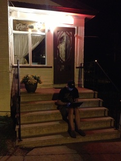 Ken at 1:45AM on the steps of the motel! Ken at 1:45AM on the steps of the motel! Last night was a late one for getting our work done. The WiFi signal didn't reach our motel room so we ended up doing our blog in the motel lobby until we felt bad for keeping the manager up so late (he felt bad about the WiFi situation, so he was very accommodating). We finished the blog sitting on the steps of the motel office at about 1:45AM...! We seem to be in a "death spiral" of sorts lately - we stay up late working on our blog, which means we wake up later in order to get enough sleep. This delays our departure times, which delays our arrivals, which means we get started on the blog late. Fortunately we are almost out of days, so things will work out just fine.
 First Tim's breakfast of the trip... First Tim's breakfast of the trip... Woodstock calls itself "New Brunswick's Oldest Town", but we must say that we found very little appealing about it. We realize that we were there for a very short time and didn't see all of it, however, we did see as we were heading for breakfast that today was parade day - so perhaps that might have changed our impressions!?! Unfortunately, we'll never know....
This morning, for the first time, we stopped at Tim Horton's for breakfast. The upside is that it's fast and cheap. It was also on our way out of town and Cam needed to use their WiFi. Tim Horton's has a pretty standard formula, however, even the Woodstock Tim's underwhelmed us.
 Thanks for nothing Gretta! Thanks for nothing Gretta! We left town around 11:00AM, and once again took a less than direct route out of town thanks to "Google Gretta". If you read yesterday's blog, you will recall that during the morning we realized that we shouldn't be blindly trusting Gretta and researched the route for the afternoon more carefully. Well, I guess that you wouldn't call us quick learners, as we set out this morning blindly trusting her once again and ended up on a rutted, muddy, dirt roadway. Fortunately, we were able to find a detour back to Main Street.
 Highway 165 was great for bikes Highway 165 was great for bikes Once we were finally out of town, we found ourselves on Highway 165 which was a delightful paved road with little traffic that ran along the St. John River. The sun was shining, and it was a beautiful day for a bike ride. Compared to riding the TransCanada Highway, the secondary highways have far more character and allow you to view more closely what life in New Brunswick looks like. Because they run alongside the river, they also usually have far fewer hills.
As we continued riding, the picturesque 165 turned into Highway 102, many sections of which used to be part of the original TransCanada highway. While there were signs of past development, we found a serious lack of services along this stretch, likely due to the building of the new TransCanada far from the river. By 3:00PM, we had ridden over 70 kms but still hadn't found a place to stop for lunch. Finally, the Kings Landing Historical Settlement appeared, and we were able to buy some overpriced sandwiches and drinks from the museum gift shop. While we would highly recommend this route for cyclists versus the TransCanada, we would also suggest that it would be a good idea to pack snacks and a lunch.
 An impressive suspension bridge along today's route An impressive suspension bridge along today's route It was a good thing we were able to find food, as the final 35 kms approaching Fredericton involved considerably more hill climbing.
Speaking of climbing, those of you who have been following our adventures might remember that on Day 3, Cam was finding that his hill (mountain) climbing capabilities were a little lacking and said that "he hopes to ride the hills of New Brunswick and PEI alongside his riding buddy Ken!" Well, now that we are here, we can advise that Cam's hope is being realized. It is interesting that we now find that our climbing capabilities are very similar. It varies from day to day, or from morning to afternoon, but generally we are very comparable in our hill-climbing - and we are both dramatically faster at climbing hills than when we began...
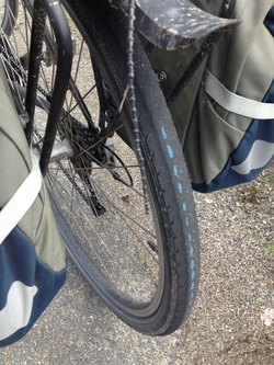 "Is my tire trying to tell me something?" "Is my tire trying to tell me something?" Once we reached the outskirts of Fredericton, we were able to find a scenic (and flat!) bike path along the river that took us to a Tim Horton's for cold drinks (thanks to Google Gretta...!). From there we were able to book a room in the Crowne Plaza Hotel in downtown Fredericton - formerly called The Lord Beaverbrook Hotel! Being downtown will allow Cam to visit a nearby bike shop first thing Monday morning to have a new back tire installed as he noticed yesterday that his tread was wearing through to the blue rubber warning strips which means there is a few hundred kilometers left in the tire. Fortunately it got him to Fredericton! (For those of you who recall that Cam replaced this tire in Brandon, Manitoba. It has lasted for 3,500 kms since then, which is pretty good considering the weight it is carrying.) After checking in and cleaning up, we headed out for supper at the rooftop patio of The Snooty Fox and enjoyed a very nice meal. We are both getting tired of restaurant food, and Ken has already put in his order for Elaine's signature marinated BBQ Pacific salmon for his homecoming! Cam will have to wait a little bit as he is meeting his family in Chicago to celebrate his fiftieth birthday after the trip is done. Our meal was followed by blogging, which has once again kept us up until after 1:00AM! This was in spite of the WiFi not allowing us to upload pictures, which means we are going to have to do that in the morning. (Note that we stopped at Tim Hortons this morning on the way out of town to upload the pictures for the blog. We plan to do the Photo Gallery when we arrive at the hotel tonight.) Ride Details:- Distance: 110.2 kms - Riding time: 5 hours, 23 minutes - Average speed: 20.5 kms/hour - Wind: East, light to moderate - Temperature: 24 degrees Celcius Tomorrow's Destination: Petitcodiac, New Brunswick - 140 kms. This was the plan, but we were not able to see any accommodations at Petitcodiac and some locals have told us not to expect much between here and Moncton. Our new plan is to ride Highway 105 and 112 towards Moncton, and take the first suitable place we see after we pass 120 kms.... We are hoping not to repeat our Shawville Motel-less experience tonight! For more ride details see Strava.and for more ride photos from today, you can check out our Photo Gallery (once we are able to get the pictures uploaded...)

Day 56 - St. Andre to Woodstock NB - 127.8 kms

Day 56 Progress to Woodstock New Brunswick - 5,661.1 kms
 Grand Falls Grand Falls We both had trouble getting to sleep last night, but even so Ken was awake before the 9:00 AM alarm went off and turned it off. This was lucky because if Cam hears that alarm one more time it's going in the toilet...! Our complimentary breakfast at the hotel included some kind of bean soup-like concoction. Perhaps a local specialty?
Although the clouds looked threatening, we felt only the occasional drop of rain as we rolled out of the parking lot around 11:00AM - which was just 2 hours after the alarm went off, an improvement from our past couple of days.
Soon we were in the neighbouring town of Grand Falls, and thanks to a missed turn found ourselves viewing a rather impressive waterfall on the St. John River - which is the origin of the town's name. As we watched a couple of people zip line across the falls to the other side, Cam wondered out loud what kind of shenanigans had gone on at these very accessible falls over the years and how many people might have drowned there.
 The TCT The TCT As mentioned in yesterday's post, our plan was to avoid the TransCanada highway in favour of routes with less traffic - and hopefully less hills. We were relying on the Google Maps bike route navigation application to help us with this. We are quite certain that no one at Google has actually ridden the route that Google Gretta took us down today! We certainly saw the "back roads" of New Brunswick, including many fields of their famous potatoes. It was nice to see more potatoes littering the road than roadkill (which we have seen much of throughout our trip).
Google Gretta was actually trying to lead us onto the "Trans Canada Trail", which is a national non-profit project to build cycling and walking trails across Canada (the "TCT"). We have avoided it on our trip thus far because it the trails have most often not been paved when we have come across them, and this was the case again today, so we stuck to the paved roads running parallel to the TCT. At one point about 30 kms into our day, we were approaching with dread a very steep and long hill on the road. Fortunately, as we approached the bottom of the hill, Google Gretta piped up and signaled that the TCT was just to our East, so we happily chose to detour to the left and to take that route! The TCT in this area is an abandoned railway right of way, and so we knew that it would avoid the large hill that had loomed along the roadway. The trail was not paved, and the recent rains had left large puddles in several places, however, we were happy to splash through them in order to avoid the hill! After riding on this for several kilometres we came to the small town of Aroostook and returned to a paved road. As we road the TCT, we also recalled that we had both made financial contributions to the development of the TCT cycle path system in Calgary about 15 years ago when our adventure was first taking form, and so it was nice to be able to take advantage of the trails now!

A wonderful lunch stop in Perth-Andover
Our route took us to the town of Perth-Andover, where we stopped for lunch at a small diner with a long name - "The 878 Waterfront Bistro & Cafe". In addition to enjoying a most delicious lunch we met the owners - Charles and Shirley - who were most friendly and interested in our adventure. We also met a nice couple from Laval Quebec - Paul and Lorraine - as well as some of the locals, including Terry, the mayor of Perth-Andover! We learned that the town had suffered a disastrous flood last spring and is still dealing with the aftermath, including the demolition of many homes and businesses.
 A gravestone in the Bishop Cemetery... A gravestone in the Bishop Cemetery... During lunch, we did some research on alternative routes - afraid to continue giving our blind faith to Google Gretta - and concluded that we should continue our journey on Highway 105, a part of the Fiddlehead River Valley Scenic Drive and running along the East side of the St. John River. This turned out to be an excellent decision as the road had good pavement and only moderate hills, but also gave us a glimpse into life in New Brunswick with nice little towns, proudly maintained houses, interesting sites and great scenery.
At one point Cam noticed a small family graveyard off to the West side of the road and for some reason felt prompted to stop and have a closer look. To his surprise, the second gravestone he read was that of a young man named Samuel Orser who at the age of 23 had "met death by by drowning at Grand Falls NB" in 1896...
 McCain Foods world headquarters! McCain Foods world headquarters! We continued riding under cloudy skies and cool (18 degree) conditions, and soon were surprised to see we were suddenly at 80 kms and entering the town of Florenceville, named in honor of Florence Nightengale and home to the corporate offices of McCains. We had noticed as we rode into town that Florenceville calls itself "The French Fry Capital of the World", however, we couldn't find anyplace to get some fries!
The other "highlight" of the afternoon was seeing the longest covered bridge in the world, which is located at Hartland. Although it wasn't on our route, we rode across the bridge and back, just so we could say we did!

That's a lot of bridge!
We then set off for the final 21 kms to our our destination at Woodstock. It was after 6PM when we were leaving, and so we were eager to finish for the day. Unfortunately, Highway 105 decided to get very hilly for the next 10 kms, so we didn't make quite as good time as we had hoped. However, just as we arrived at Woodstock at 7PM, the sun finally broke through the clouds - a fitting end to a great day! Ride Details:- Distance: 127.8 kms - Riding time: 6 hours, 1 minute - Average speed: 21.2 kms/hour - Wind: Northwest, light to moderate (!) - Temperature: 18 degrees Celcius - Cumulative: 5,661.1 kms Tomorrow's Destination: Fredericton, New Brunswick - 105 kms For more ride details see Strava and for more photos from today's ride see our Photo Gallery.

Day 55 - Edmundston to St. Andre NB - 49.6 kms

Day 55 - Progress to St. Andre NB - 5,533.6 kms
We arrived late to Edmundston last night, and even later to the Days Inn, which required that we ride an extra 8 kms from our dinner spot. One of the reasons that we agreed to ride that extra 8 kms (rather than take a hotel close to the restaurant) was that being closer to our destination tomorrow would allow us to sleep until we woke up without an alarm. With just 90 kms the next day we weren't worried about a late departure. Unfortunately, when we finally shut the lights out at 2:30AM we realized that the free continental breakfast ended at 10AM and the CFO of the team (Cam) wouldn't approve a paid breakfast when we could get one for free! So we set a 9:30AM alarm and didn't get the extra sleep that we had both been looking forward to.
Speaking of the CFO, it is interesting as we come to the end of the adventure to see how clearly our relative strengths (and weaknesses) have translated into our respective roles on this adventure. It is not that dissimilar to the leadership of a company.
We are co-CEO's of C&K Adventure Corporation, both having had the vision and passion to bring the adventure to life.  Our CFO at work (note that we have a lax dress code!) Our CFO at work (note that we have a lax dress code!) Cam is the Chief Financial Officer (CFO) and the Chief Information Officer (CIO) - responsible for budgeting, cost accounting/reporting, and historical information capture/reporting. (He is aided in these tasks by his amazing memory - he can name, in order, the towns we have stayed in and the accommodation where we stayed!) He has dutifully maintained a detailed spreadsheet on a daily basis capturing all financial and ride information. (For those of you who may have wondered, we take turns paying for the meals and hotels and through this spreadsheet ensure that we have both paid for about 50% of the total costs. By the time we are done, we will be very close to equal in what we have each paid and a small adjustment might be required. The CFO has it all under control!)
 Our CTO managing some of our technology Our CTO managing some of our technology Ken is the Chief Operating Officer (COO) and the Chief Technology Officer (CTO) - responsible for execution of the plan, attention to the details, risk mitigation, bicycle technology and bicycle maintenance. He is very careful to look forward and ensure that we are proactively managing all details to avoid issues and problems. You've also seen the deployment of technology on his handlebars that provides information required by the CIO...!
 A dark and gloomy "road ahead" picture... A dark and gloomy "road ahead" picture... Once again, the morning time warp hit us and it wasn't until noon that we were getting on our bikes after a 9:30AM alarm. One of the reasons for the delay was that as Cam was getting on his bike, he did a pocket check and realized his wallet was missing. After a check of his bags, he concluded it must be in the room and went back, relieved to find that an information card had fallen over top of it on a counter. Finally ready to leave, and having taken our "road ahead" picture, we felt the first raindrop...the first of many that would follow on a very wet day. This slowed us further as we had to dig out our pannier covers and cover up our bags.
 Ken leaning into the headwind as he crests a hill... Ken leaning into the headwind as he crests a hill... Finally, we got going with a moderate headwind. We hadn't yet made a hotel reservation and so we decided that we would ride a quick 30 kms to a Tim Hortons in St Leonard and then call for a hotel reservation at our destination, Perth-Andover. This 30 kms turned out to be not-so-quick. The TransCanada Highway gave us plenty of climbing with three hills of about 2 kms and grades of 5 - 6% over that 30 kms in a heavy rain. We arrived at the Tims wet and tired.
Unfortunately (or fortunately as we later realized), the hotels in Perth-Andover were completely full because of a tournament of some sort in town over the weekend. One of the clerks told us that we should try hotels in Grand Falls - which was just 19 kms Southeast from where we sat in the Tim Hortons. We managed to reserve a room at the St. Andre Quality Inn, just outside of Grand Falls. We decided we would have a short day today (about 50 kms), leaving a ride of 110 kms on Saturday - which wasn't so bad. This would give us a bit of a "mini" rest day today and lifted our spirits knowing that we weren't going to have to climb any more big hills today!
 Highway 144 is part of the "Fiddlehead Scenic Drive" Highway 144 is part of the "Fiddlehead Scenic Drive" One of the unforeseen benefits of this turn of events was that the route to the Quality Inn took us to Highway 144, a secondary highway that follows the St. John River. This highway, about 5 kms Southwest of the TransCanada, was almost empty. It had great shoulders and far fewer and shorter hills than the TransCanada, and we were also happy to see that the wind had shifted and was now behind us. We will be able to follow this , and other secondary highways all the way to Fredericton, which should make for a very pleasant ride. This highway forms part of the Fiddlehead Scenic Drive that follows the St. Johns River from the Quebec border to the Bay of Fundy. We are very much looking forward to following this route as we approach the finish line.
Cam used our "found time" this afternoon to get some administrative work done (yuck!), while Ken was able to have a nice nap and also did our laundry (one of the COO's responsibilities...)! We were able to get everything done, and are heading to bed an hour or two earlier than we are accustomed!
Good Night and Bon Nuit (New Brunswick is 50/50 English/French in our experience so far).
Ride Details: - Distance: 49.6 kms - Ride time: 2 hours, 24 minutes - Average speed: 20.7 kms - Wind: Southeast, moderate. Changed to Northwest after Tims... - Temperature: 14 degrees and constant rain (there is a rain warning in the area until 8AM!) - Cumulative: 5,533.6 kms Tomorrow's Destination: Woodstock, New Brunswick - 110 kms For more ride details, see Strava and for more ride photos see our Photo Gallery.
 Leg 6 - The Maritimes  Day 54 - Riviere-du-Loup QC to Edmundston NB - 135.0 kms  Day 54 - Progress to Edmundston NB - 5,484.0 kms  Our last view of the St. Lawrence Our last view of the St. Lawrence Neither of us are "morning people", but for some reason, this morning it was even harder than usual to drag ourselves out of bed. We then entered the time/space continuum, where from the time the alarm goes off until we have finished breakfast (at the restaurant right next door) and are getting on our bikes, three hours somehow goes by!
We had the option of riding on a bike path today but decided against it because:
a) we didn't know what type of surface we would be riding on,
2) it was approximately 15 kms longer than the 120 km highway route, and
III) we were losing an hour today due to the final time change in New Brunswick.
|  Hello Trans Canada Highway... Hello Trans Canada Highway... So we found ourselves back on the shoulder of our old friend the TransCanada highway. It was a bit of a shock to the system to have semi-trailers roaring past us again! Trucks were banned from the highways that we have ridden since Montreal unless they were local. It was also strange (in a bad way) to be climbing substantial hills again as we head inland from the St. Lawrence River. The hills are long/steep enough inclines to warrant a passing lane. After about 4 days of relatively level countryside following along the St. Lawrence, our research indicates there will be more hills in our future.
|  ...and hills! |  Hills aside, today was another beautiful day for riding!  The Ha' Ha' sign | After about 55 kms we began to look for lunch opportunities, and were intrigued when we saw signs for a town called Saint-Louis du Ha' Ha' (I am not making this up!) We found a quaint little diner called Cantine Choupi, hoping to find out more about the town's name.
|  Our waitress Audrey | Although the food was delicious and the service superb, the staff couldn't shed any light on the origins of the town's unusual name. (Cam's subsequent research indicated several possible explanations, but general confusion on the actual source. Officially, the explanation is that it is derived from the name of a nearby lake "Lake Temiscouata", with the "Ha Ha" coming from "...couata"... Cam liked the other explanations which were much more interesting!)
The afternoon featured several stretches of construction involving twinning the TransCanada highway. This made for less than ideal riding conditions. At one point we saw a section of completed highway that was not open to traffic yet, however the pavement ended shortly after we began riding on it, so it was back to sharing the highway with vehicles.  Our "short-lived" private highway  Today, we entered into our 11th Province/State! Today, we entered into our 11th Province/State! Late in the afternoon we were excited to cross the border into New Brunswick, and into Leg 6 of our adventure - "The Maritimes". In spite of our excitement, we have fond memories of our time in Quebec and will both miss it. The fact that the province is so different from Alberta has made it a most excellent part of our adventure.
Cam's in-laws hail from New Brunswick and so he called his mother-in-law Sharon as he crossed the border to share his first visit in the province with her. Unfortunately, we won't be going close to St. John, where they were from.
 The latest we've been on the highways - after 9PM... The latest we've been on the highways - after 9PM... The combination of a late start, numerous hills and a time change meant we didn't arrive in the Edmundston area until about 7:30PM. The town seems to stretch forever along the highway. For the first time on the trip, we elected to stop for supper before checking into a motel and cleaning up. We made a great choice for our meal - Pizza Delight features delicious roasted chicken with a salad/fruit bar and also a bread bar! You could grill your choice of bread and then choose from several awesome butter spreads. The price was also right as our dinner cost us less than breakfast this morning!
We used the time in the restaurant to choose a hotel for the night as we didn't expect it would be a problem to arrive here on a Thursday night and find a room. We underestimated the demand for hotel rooms in this town, however, and found the rates to be quite expensive. We chose the Days Inn, which required us to ride another 8 kms (and several hills) - which is still considered to be in Edmundston! It was after 9:00PM when we were doing this ride, and so we had to use our flashing taillights to ensure that we could be well seen. This is by far the latest that we have been on the highways on our trip so far, and we hope it is the last. It was 9:30PM by the time we got to the hotel.
One advantage to the change in our dinner/motel procedure is we can avoid digging out street clothes after showering, and just put on our "night wear". Perhaps this will significantly speed up our morning routine....!
 A late arrival and a cross-country trip to get to the hotel! Ride Details: - Distance: 135.0 kms - Riding time: 6 hours, 30 minutes - Average speed: 20.8 kms - Wind: Northwest (light) - Temperature: 24 degrees Celcius - Cumulative: 5,484.0 kms Tomorrow's Destination: Perth-Andover, New Brunswick - 90.0 kms For more ride details, see Strava and for more pictures from today's ride, see our Photo Gallery!

Day 53 - L'Islet-Sur Mer to Riviere-du-Loup QC - 112.7 kms

Day 53 - Riviere-du-Loup QC - 5,349.0 kms
 Saying goodbye to our most excellent hostess Gilberte! Saying goodbye to our most excellent hostess Gilberte! We awoke at 8:30AM to the sound of the waves of the St. Lawrence lapping the shore. This was in contrast to last night's calm, and was good news for us in that it meant a strong wind was blowing out of the Southwest. By about 10:00AM we were saying goodbye to our hostess and were ready for our morning surprise - the bill for our night's stay in the deluxe condo. Cam held his breath as Gilberte passed him the bill and gasped (using his inside voice) when he saw that it was $100 plus tax! The Aux Deux Marees was our best paid accommodations yet and we would highly recommend that if you are going through L'Islet-Sur-Mer, you should stay with our new friends Gilberte and Jean-Marc!
 Chasing the storm clouds East Chasing the storm clouds East We could see the dark clouds that had produced an overnight thunder and lightning storm ahead of us in the Eastern sky, but thanks to web weather apps we knew they were heading East and there was no weather following closely behind. The tailwind did not disappoint and was directly behind us as we headed Northeast to find a place for breakfast. We continued about 10 kms down the road to St. Jean-Port-Joli and as we rode we saw many charming art galleries, shops and restaurants.

A very delightful town in Eastern Quebec.
| We stopped in the middle of the town for a delightful breakfast at Resto Libellule, a popular local establishment. There were at least 8 people working there this morning illustrating how these types of businesses are great for the local economy. Ken would love to return for another meal! In fact, we both agreed that the area East of Quebec City looked like it would be one of the most interesting and enjoyable sections to come back and visit at some point in the future! |

A very delightful Resto Libellule breakfast
|  Our long lost friend - the TransCanada Highway Our long lost friend - the TransCanada Highway After breakfast it was back on the bikes under sunny blue skies to take advantage of the strong wind at our backs. Fortunately, Denise and Carole had warned us yesterday that part of Highway 132 was closed for roadwork, and the Innkeeper Jean-Marc had given us a map showing the detour we should take. Unfortunately, we missed the suggested turn South by about 1.5 kms and had to backtrack a little bit. The detour led us back across the TransCanada highway which runs around 5 kms to the South of the 132. As we crossed it, we were reminded of how awesome the cycling has been in Quebec with low traffic roads, wide shoulders and interesting riding. We certainly don't miss the TransCanada - although it had been our path through almost all of Western Canada and Ontario. The roads on the detour were fine until they turned to gravel for the final 3 kms. In total, the detour cost us about 8 kms - which could have been a lot worse.
 We were making such good progress that by the time we reached the town of Kamouraska, we actually felt we were about to catch up to the dark clouds! Not wanting to get wet if we could help it, we paused at Le Bistro Cote-Est where locally produced breads, cheese and meat are featured. While we were enjoying a delicious gourmet grilled cheese sandwich (featuring a delicious local cheese) something strange was happening in the skies above us. We emerged to find the skies had clouded over, the tailwind had changed to a slight headwind, and the temperature had dropped about 10 degrees! Ken couldn't remember the last time he had stopped to put his riding jacket on!

La Bistro Cote-Est... 5 points for what's wrong with this picture?
Highway #132 continues to follow the South coastline of the St. Lawrence River, and provided many opportunities for photo ops along the way. The further North we rode today, the more we began to see the Maritime influence in the houses and landscape.

A young moose feeding on the shore.
We reached Rivière-Du-Loup (Wolf River) about 5:30PM and found a room at Motel Au Vieux Piloteu. Tomorrow we turn South and begin the final leg of our journey into New Brunswick and then towards Charlottetown. Ride Details:- Distance: 112.7 kms - Riding time: 4 hours, 53 minutes - Average speed: 23.1 kms/hour - Wind: Southwest, strong, changing to Northeast and light for the final 1/3 - Temperature: 23 degrees, declining to 14 degrees after lunch - Cumulative: 5,349 kms Tomorrow's Destination: Edmundston, New Brunswick - 118 kms For more ride details see Strava and for more photos from today see our Photo Gallery.
|
 Charlottetown PEI - The End!
  I can't believe she hugged me!